Pronóstico del tiempo para 10 días
Ciudades :
| temperaturas, Tiempo | Viento |
Isla de São Vicente, Cabo Verde
| Viento (medio/ráfagas) en kt | ||||||||||||||||||||||||
| fecha |
| |||||||||||||||||||||||
| domingo 02 |  08/09 |  05/05 | ||||||||||||||||||||||
| lunes 03 | 03/03 |  03/03 |  02/02 | 04/03 |  01/03 |  03/05 |  02/03 | 05/06 | ||||||||||||||||
| martes 04 |  05/06 |  04/04 | 02/04 | 02/04 |  05/06 | 06/11 |  04/06 |  02/04 | ||||||||||||||||
| miércoles 05 | 04/04 | 03/04 | 04/05 | 03/02 |  02/02 |  01/03 | 01/02 | 04/05 | ||||||||||||||||
| jueves 06 | 04/04 | 03/04 | 02/02 | 02/02 | 08/06 | 07/06 | 05/05 | 03/03 | ||||||||||||||||
| viernes 07 | 03/03 | 02/02 | 02/02 | 04/04 | 06/06 | 08/07 |  04/04 | 08/08 | ||||||||||||||||
| sábado 08 | 07/07 | 08/08 | 07/08 | 12/13 | 14/16 | 14/16 | 12/13 | 10/10 | ||||||||||||||||
| domingo 09 | 09/11 | 11/12 | 10/12 | 15/16 | 16/17 | 15/16 | 12/14 | 11/13 | ||||||||||||||||
| lunes 10 | 12/13 | 11/13 | 11/14 | 13/16 | 15/16 | 14/15 | 13/13 | 12/13 | ||||||||||||||||
| martes 11 | 11/12 | 10/11 | 12/13 | 15/15 | 16/15 | 14/13 | 12/12 | 08/08 | ||||||||||||||||
| Cambiar las unidades ( kt, m/s, km/h, mph) | ||||||||||||||||||||||||
Pronóstico del tiempo para los próximos 10 días en ciudades de todo el mundo.
Los puntos rojos representan las ciudades disponibles.
Ponga el ratón en el punto deseado para ver el nombre de la ciudad.
Haga clic para ver los pronósticos meteorológicos.
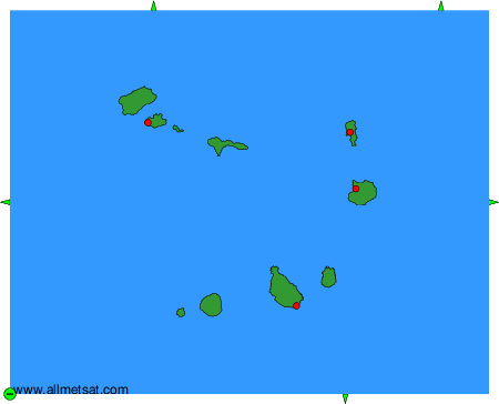
Para cambiar el mapa : haga clic en los botones verdes con una cruz de color negro para hacer un zoom, en el botón verde con un guión para alejar o en las flechas verdes para mapas adyacentes.