METAR-TAF
Aeropuertos :
Rochester
Aitkin
Albert Lea
Ames
Ankeny
Antigo
Appleton
Ashland
Aurora
Austin
Baraboo / Wisconsin Dells
Benton Harbor
Black River Falls
Boone
Boscobel
Buffalo
Burlington
Cambridge
Camp Douglas
Cedar Rapids
Chariton
Charles City
Chicago
Chicago-Midway
Clarion
Clinton
Clintonville
Cloquet
Cumberland
Davenport
Decorah
DeKalb
Des Moines
Dodge Center
Dubuque
Duluth
Duluth
Eagle River
Eau Claire
Elkhart
Escanaba
Eveleth
Fairfield
Faribault
Fond du Lac
Forest City
Frankfort
Freeport
Gary
Grand Rapids
Green Bay
Grinnell
Hancock
Hayward
Hibbing
Holland
Independence
Iowa City
Iron Mountain / Kingsford
Ironwood
Janesville
Joliet
Juneau
Kankakee
Kenosha
Knoxville
Lacon
La Crosse
Ladysmith
Land O' Lakes
Lansing
Lone Rock
Ludington
Madison
Manistee
Manistique
Manitowoc
Mankato
Maple Lake
Marquette
Marshalltown
Marshfield
Mason City
McGregor
Medford
Menominee
Menomonie
Merrill
Milwaukee
Milwaukee
Mineral Point
Minneapolis
Minneapolis / Blaine
Minneapolis / Crystal
Minneapolis / Eden Prairie
Minneapolis / Lakeville
Minocqua / Woodruff
Moline
Monroe
Monticello
Moose Lake
Mora
Morris
Mosinee
Munising
Muscatine
Muskegon
New Richmond
Newton
Oelwein
Osceola
Oshkosh
Ottumwa
Owatonna
Pella
Peru / LaSalle
Phillips
Platteville
Prairie du Chien
Preston
Princeton
Racine
Red Wing
Rhinelander
Rice Lake
Rochelle
Rochester
Rockford
Romeoville
Rush City
Saint Paul
Savanna
Shawano
Sheboygan
Silver Bay
Siren
South Bend
South Haven
South St. Paul
Sparta
Stanton
Sterling / Rock Falls
Stevens Point
Sturgeon Bay
Superior
Tomahawk
Two Harbors
Valparaiso
Vinton
Waseca
Washington
Waterloo
Watertown
Waukegan
Waukesha
Waupaca
Wausau
Webster City
West Bend
West Chicago
Wheeling / Prospect Heights
Winona
Wisconsin Rapids
Wisconsin
América del Norte
Illinois
Indiana
Iowa
Míchigan
Minnesota
Ohio
Ontario, norte
Rochester International Airport Rochester, Minnesota, Estados Unidos
latitud: 43-54-15N, longitud: 092-29-30W, altitud: 401 m
Observación El informe se hizo hace 53 minutos, a las 19:54 UTC
Viento 14 kt del este con ráfagas de 23 kt
Temperatura 7 °C
Humedad 49 %
Presión 1021 hPa
Visibilidad: 16.1 km
Cielo despejado
METAR: KRST 011954Z 09014G23KT 10SM CLR 07/M03 A3014 RMK AO2 SLP217 T00671033
Hora: 15:47 (20:47 UTC) Pronóstico El informe se hizo hace 3 horas y 27 minutos, a las 17:20 UTC
Pronóstico válido del 01 a las 18 UTC al 02 a las 18 UTC
Viento 14 kt del este con ráfagas de 22 kt
Visibilidad: 10 km
Cielo nuboso a una altura de 10000 ft
A partir de las 02 a las 0400 UTC
Viento 16 kt del este con ráfagas de 24 kt
Visibilidad: 9.7 km
Cielo cubierto a una altura de 3000 ft
lluvia ligera
A partir de las 02 a las 0700 UTC
Viento 18 kt del este con ráfagas de 27 kt
Visibilidad: 8.0 km
Cielo cubierto a una altura de 800 ft
lluvia ligera
A partir de las 02 a las 1000 UTC
Viento 19 kt del este con ráfagas de 28 kt
Visibilidad: 6.4 km
Cielo cubierto a una altura de 800 ft
lluvia ligera
A partir de las 02 a las 1300 UTC
Viento 20 kt del este con ráfagas de 27 kt
Visibilidad: 3.2 km
Cielo cubierto a una altura de 500 ft
lluvia engelante
A partir de las 02 a las 1500 UTC
Viento 16 kt del este-noreste
Visibilidad: 3.2 km
Cielo nuboso a una altura de 500 ft
chaparrones de lluvia
TAF: KRST 011720Z 0118/0218 10014G22KT P6SM BKN100 FM020400 08016G24KT 6SM -RA OVC030 FM020700 08018G27KT 5SM -RA OVC008 FM021000 09019G28KT 4SM -RA OVC008 FM021300 08020G27KT 2SM FZRA OVC005 FM021500 07016KT 2SM SHRA BKN005
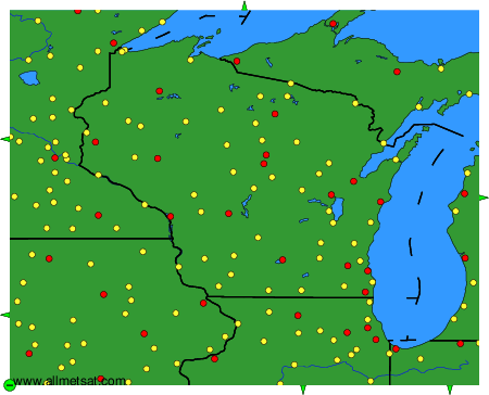
Observaciones y pronósticos meteorológicos de más de 4000 aeropuertos (mensajes METAR y TAF).
Los puntos amarillos y rojos representan las estaciones disponibles.
Ponga el ratón en el punto deseado para ver el nombre de la estación.
Haga clic para ver las observaciones y los pronósticos meteorológicos.
Para cambiar el mapa : haga clic en los botones verdes con una cruz de color negro para hacer un zoom, en el botón verde con un guión para alejar o en las flechas verdes para mapas adyacentes.