Pronóstico del tiempo para 10 días
Ciudades :
Kingston
Acapulco
Alert
Anchorage
Atlanta
Barranquilla
Bermudas
Billings
Boston
Calgary
Caracas
Charlotte
Chicago
Chihuahua
Churchill
Ciudad de Belice
Ciudad de Guatemala
Ciudad de Panamá
Ciudad Guayana
Ciudad Juárez
Culiacán
Curazao
Dallas
Denver
Detroit
Edmonton
Fairbanks
Fort-de-France
Georgetown
Guadalajara
Halifax
Hermosillo
Houston
Indianápolis
Iqaluit
Isla del Príncipe Patrick
Jacksonville
Juneau
Kansas City
Kingston
La Habana
Las Vegas
Los Ángeles
Lubbock
Managua
Maracaibo
Memphis
Mérida
México
Miami
Minneapolis
Monterrey
Montreal
Nasáu
Nashville
Nueva Orleans
Nueva York
Nuuk
Ottawa
Phoenix
Pittsburgh
Pointe-à-Pitre
Puerto España
Quebec
Resolute
Sachs Harbour
Salt Lake City
San Antonio
San Francisco
San Juan
San Juan de Terranova
Santo Domingo
Saskatoon
Seattle
Sint Maarten
Spokane
Tegucigalpa
Thule
Toronto
Tuxtla Gutiérrez
Vancouver
Winnipeg
Yellowknife
América del Norte
Alabama
Alaska, Anchorage
Alaska, Anchorage Fairbanks
Alaska, Columbia Británica
Alberta
América del Sur
Antillas menores
Arizona
Arkansas
Bahamas
Belice
Bermudas
California, Los Ángeles, San Diego
California, norte
California, sur
Carolina del Norte
Carolina del Sur
Colorado
Columbia Británica
Costa Rica
Cuba
Dakota
Delaware
El Salvador
Florida
Georgia
Guatemala
Haití
Honduras
Idaho
Illinois
Indiana
Iowa
Jamaica
Kansas
Kentucky
Luisiana
Manitoba
Maryland
México
México, este
México, noreste
México, noroeste
México, suroeste
Míchigan
Minnesota
Misisipi
Misuri
Montana, este
Montana, oeste
Nebraska
Nevada
Nicaragua
Norte del Atlántico
Norte del Pacifico
Nueva Inglaterra
Nueva York
Nuevo México
Nunavut
Nunavut, Isla de Baffin, Ellesmere
Océano Ártico
Ohio
Oklahoma
Ontario, norte
Ontario, sur
Oregón
Panamá
Pensilvania
Provincias marítimas
Puerto Rico
Quebec
Quebec, sur
República Dominicana
Saskatchewan
Sur del Pacifico
Tennessee
Territorios del Noroeste
Texas, este
Texas, oeste
Texas, sur
Trinidad y Tobago
Utah
Venezuela
Virginia
Washington
Wisconsin
Wyoming
Yukón
Kingston, Jamaica Viento (medio/ráfagas) en kt fecha noche mañana tarde anochecer 01 04 07 10 13 16 19 22
miércoles 24 jueves 25 viernes 26 sábado 27 domingo 28 lunes 29 martes 30 miércoles 01 jueves 02 viernes 03 Cambiar las unidades ( kt, m/s, km/h, mph)
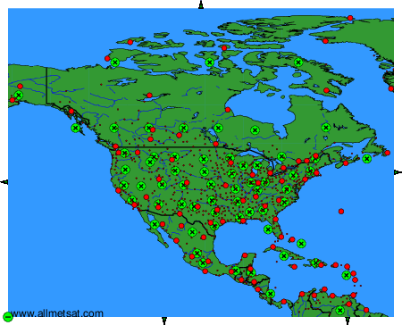
Pronóstico del tiempo para los próximos 10 días en ciudades de todo el mundo.
Los puntos rojos representan las ciudades disponibles.
Ponga el ratón en el punto deseado para ver el nombre de la ciudad.
Haga clic para ver los pronósticos meteorológicos.
Para cambiar el mapa : haga clic en los botones verdes con una cruz de color negro para hacer un zoom, en el botón verde con un guión para alejar o en las flechas verdes para mapas adyacentes.